Maps Page on Thailand
Outline
- Physical Environment
- Vegetation zones
- Elevation map
- Relief map
- Weather & Climate
- Climate regions
- Golf Weather
- Temperature and Precipitation
Ranges
- Human Environment
- Ethnic Regions
- GDP
- Education Levels
- Road maps
- Major and Minor Roads
- Map of Expressway, Roads,
Railways, and Major Cities
- Bangkok Roads
- City Maps
- Major cities with Transportation
- Simply Cities Map
- Thailand Provinces
- Urban Transportation Maps
- Passenger Trains and Busses
Across Thailand
- Bangkok Expressway
- Thailand’s Railways
- Tourist Maps
- South-East Thailand
Attractions
- Phuket Activates
- Thailand’s Major Attractions
1 Physical Environment
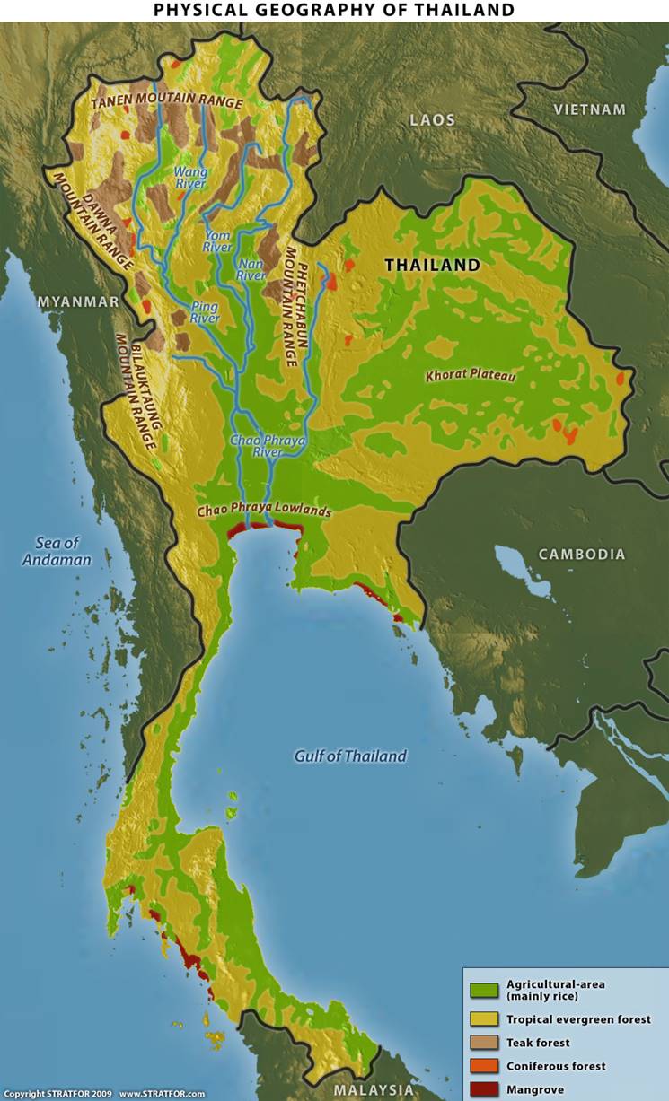
1. Here we can see the vegetation zones of Thailand. It also shows the
names of the major mountain ranges and rivers. Its useful in creating a mental
picture of what Thailand will look like in certain areas. https://worldview.stratfor.com/article/geopolitics-thailand-kingdom-flux
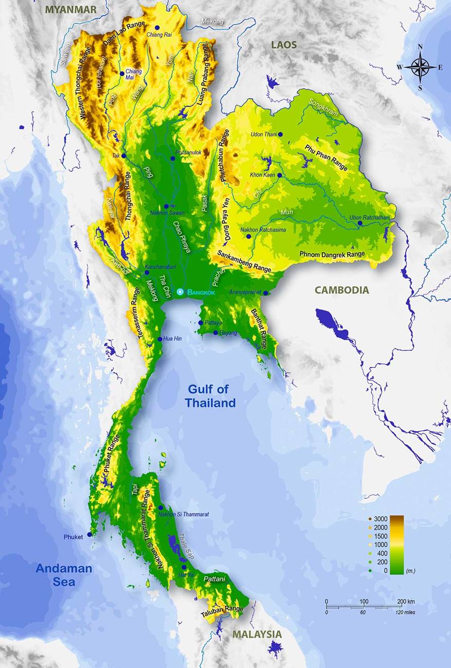
2. This shows elevation and
mountain ranges. High elevation areas mountain ranges are brown and represent
3000 ft and sea level is green. Helpful in figuring how much change in elevation
you’ll be experiencing.
http://libertaddeeleccion.org/physical-map-of-thailand/
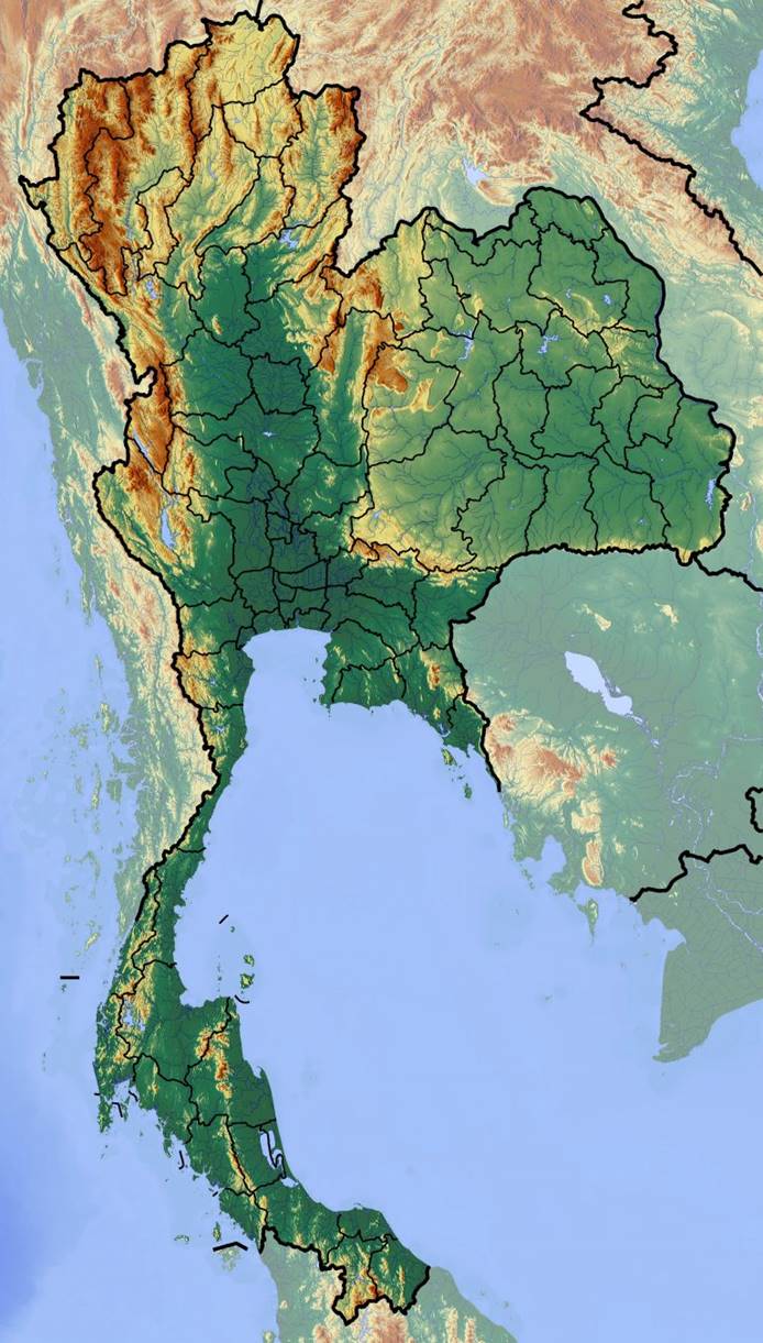
3. This is a
detailed relief map showing the hills, valleys and contour lines. http://tuquyhai.com/physical-map-of-thailand/large-relief-map-of-thailand-valid-maps-physical-maps-of-thailand-high-resolution-map-physical-map-of-thailand/
2 Weather & Climate
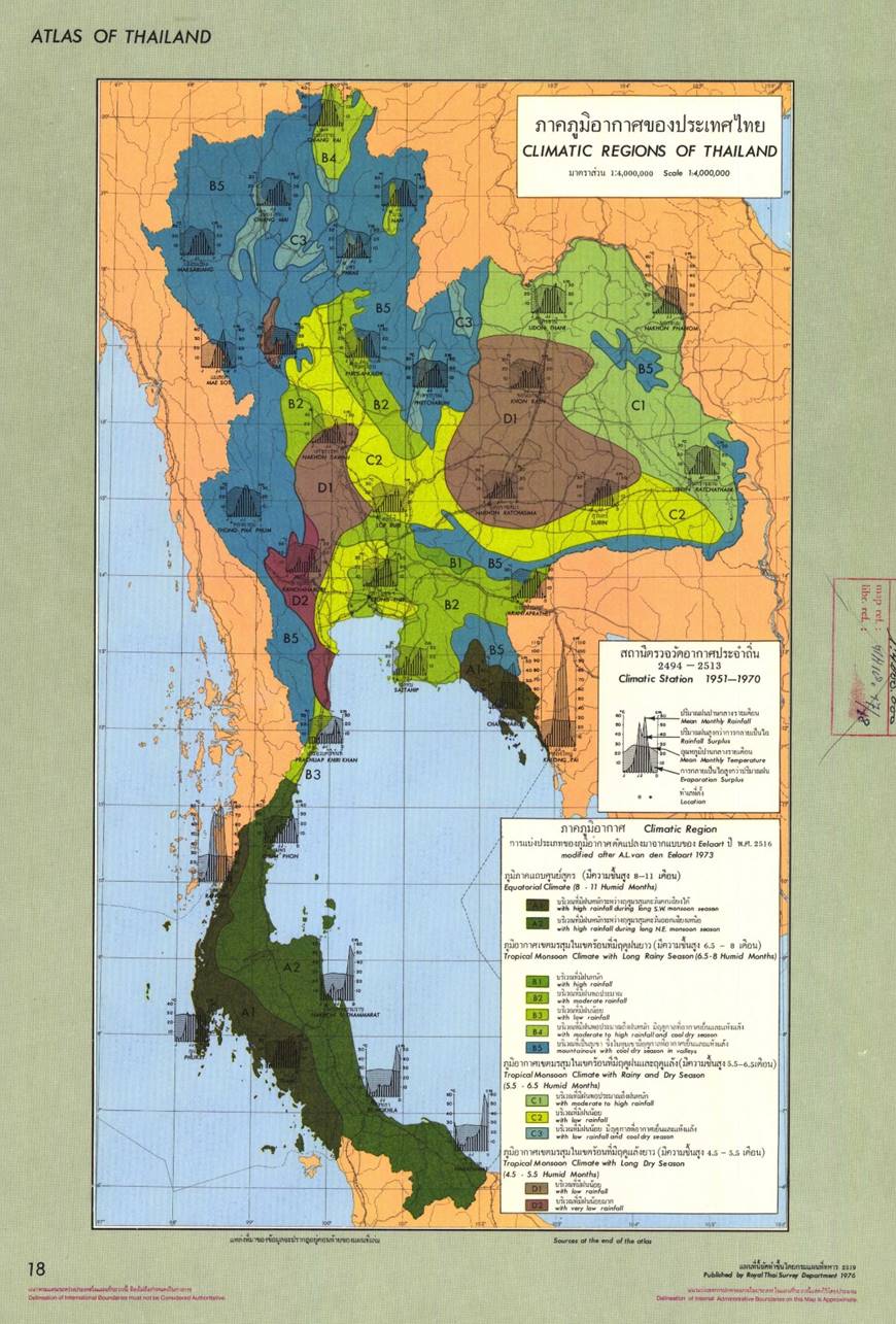
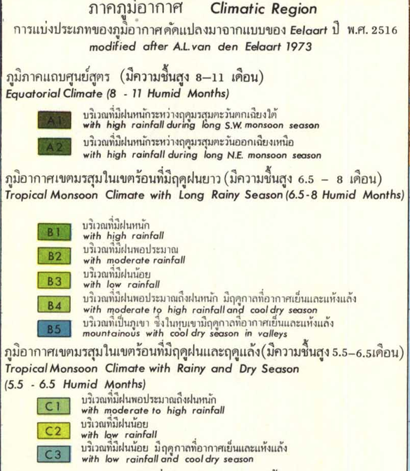
1. Here we can see the differences in climate by region. It categorizes them based off rainfall and humidity. It would be specifically helpful in deciding when and where to visit for optimal weather. https://www.researchgate.net/profile/Suvaluk_Asavasanti/publication/257840456/figure/fig6/AS:668504571277324@1536395318832/Map-Showing-the-Various-Climatic-Regions-in-Thailand.jpg

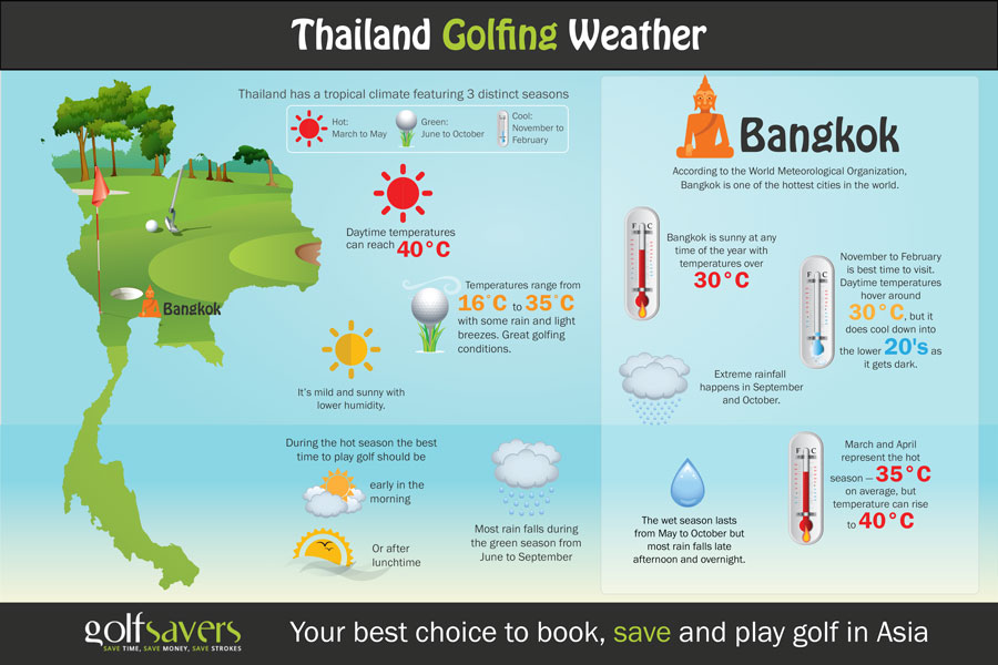
2. This map shows the location of Bangkok, and gives information about the different season and temperatures that is helpful to travelers. https://www.golfsavers.com/assets/image/Bangkok-Weather.jpg
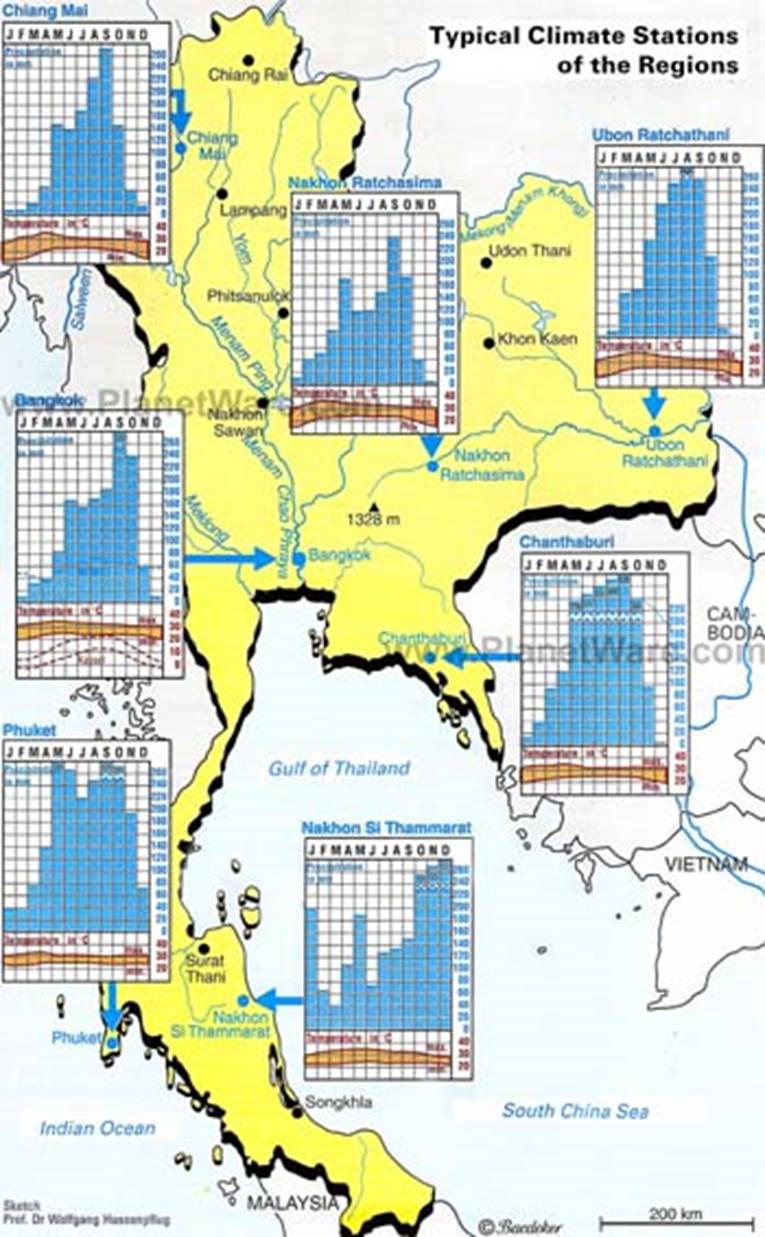
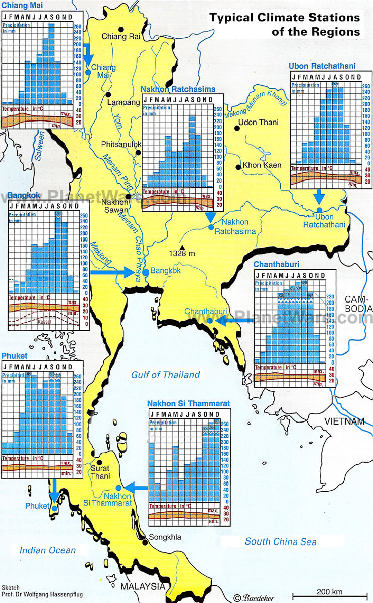
3. This is the year-round temperature and percipitation ranges for different locations in Thailand. It is helpful with planning when and where to travel for optimal weather. https://media.routard.com/image/forum/100/5/8c54b680e53cf068011c8cc2db984748.w740.jpg
3 Human Environment
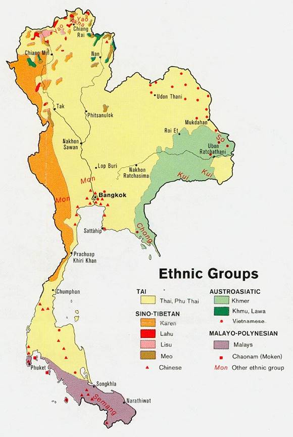
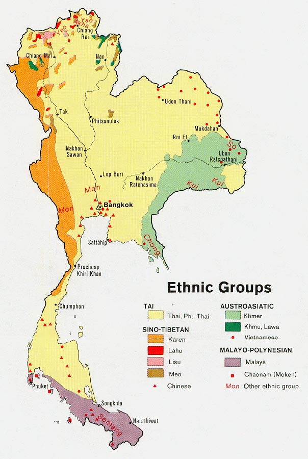
1. Many ethnic groups call Thailand home. Above shows the different groups in categories and where they are locationally. http://legacy.lib.utexas.edu/maps/middle_east_and_asia/thailand_ethnic_1974.jpg
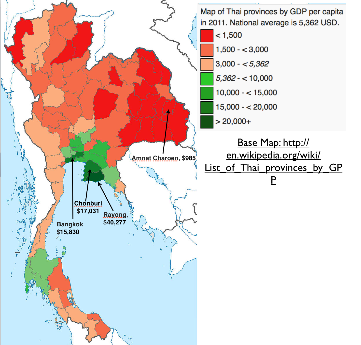
2. This map shows the GPD per capita in 2011. The gradient is from red to green, green being higher GDP areas. This shows us that Thailand is overall not economically healthy, Rayong being the area with the best economy, significantly higher income. Surprised by this I investigated further and found that this outlier is because the GDP was calculated by where you work, not where you live. A lot of people not living in these areas work here because there are a lot of factories, but live elsewhere. So really Rayong resident make average wages, it’s not really a wealthy town. http://www.geocurrents.info/wp-content/uploads/2014/05/Thailand-GDP-by-Region-Map.png
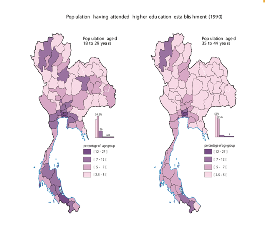
3. This map shows higher education in Thailand. It breaks it into 2 separate
maps, 18-29 years old and 35 to 44 years old. The younger generation has
significantly higher education, which shows that education opportunities are
getting better. However, 27% being the highest parentage is still really low. http://www.cartographie.ird.fr/images/thailande/educ.gif
4 Road Maps
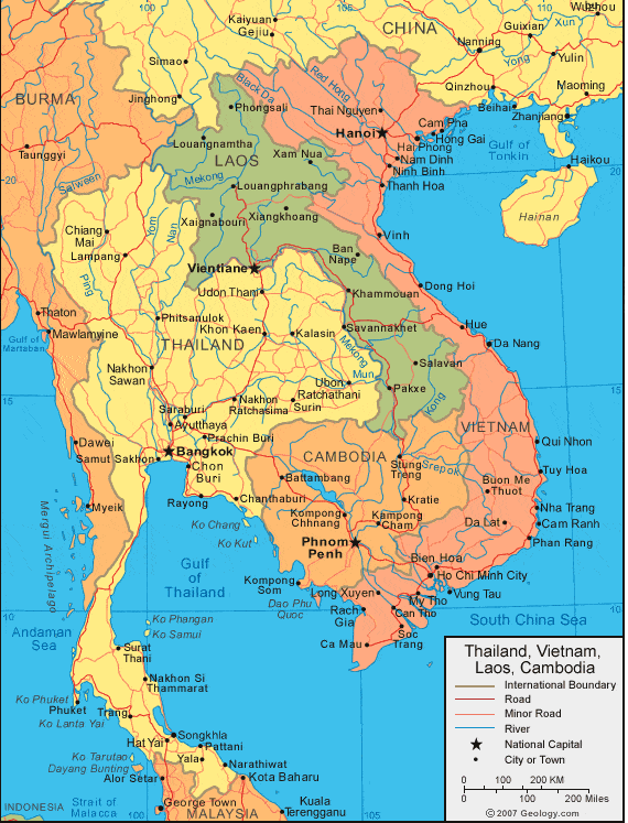
1. Here we can see the roads in Thailand and the bordering countries. It
splits the roads by color into minor and major roads. Helpful if planning
travel to a bordering country. https://i1.wp.com/www.turkey-visit.com/images/vietnam/map-of-vietnam.jpg
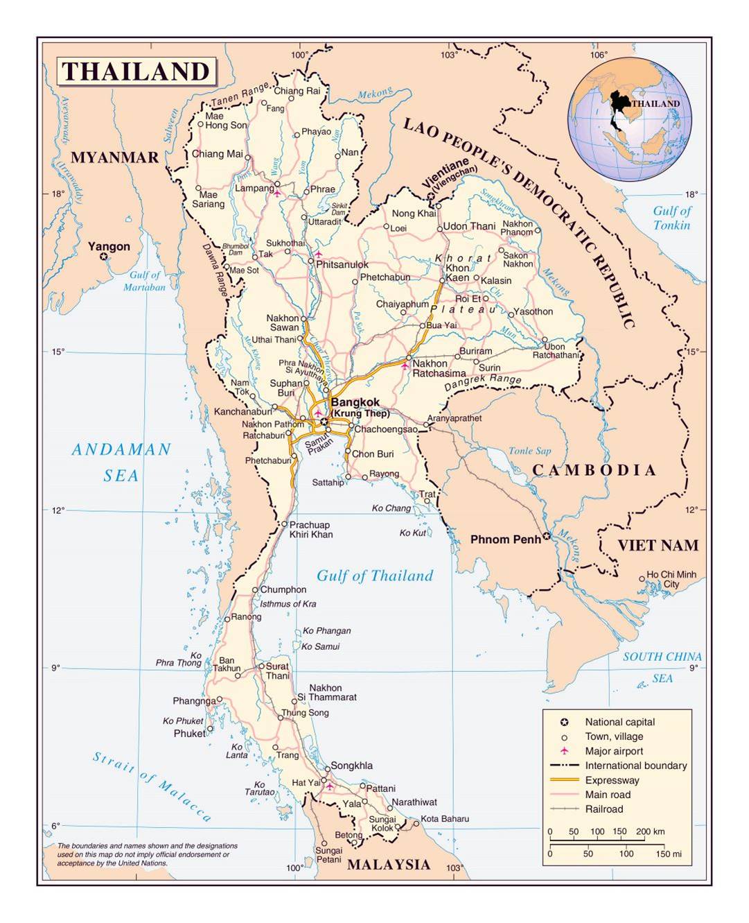
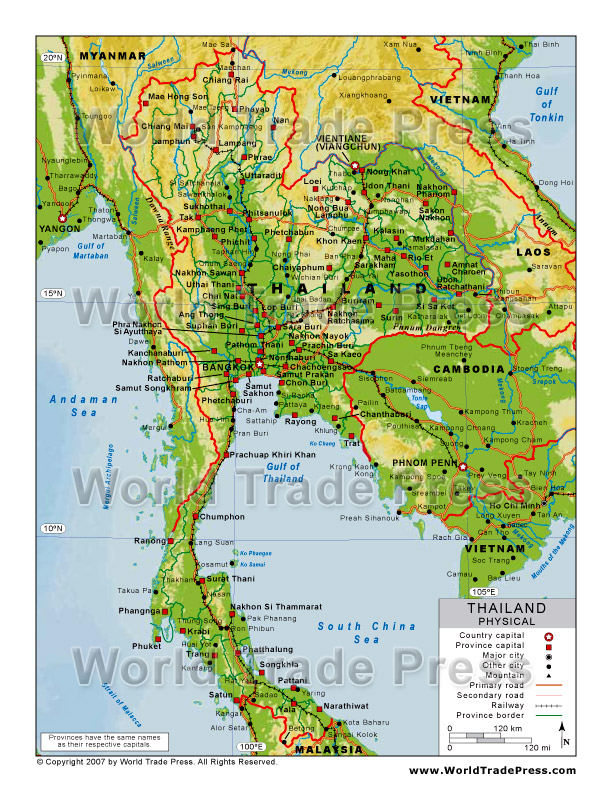
2. This map shows the expressway, main roads and railroads, with the Bangkok airport clearly labeled. It would be helpful in planning the best transportation from the airport to location.
3. This road map is of Bangkok and is interactive on the website. It shows the main highways and their numbers ( which was very hard to find a map that included) as well as minor streets. IT would be helpful if planning to drive around in Thailand, or even just walk around because you can zoom in and see smaller locations/ more specific streets and street names. http://www.bangkok-maps.com/
5 City Maps
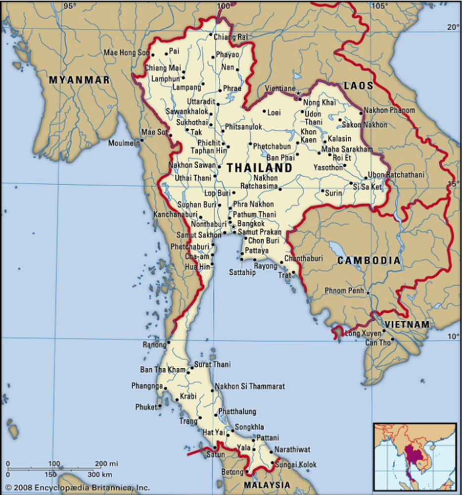
1. This cities map classifies
cities into major cities, province capitals, and other cities. It also shows
railways, primary road, and secondary roads. This map would be specifically
helpful in trying to plan transportation from city to city or to Cambodia.
2. This cities map is easy on the
eyes, not cluttered with roads and mountains, just shows the names of the
cities. https://saletur.ru/galery/tfoto_map/big/319.jpg
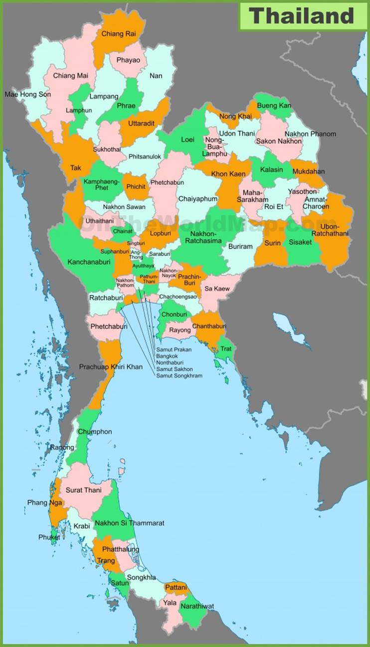
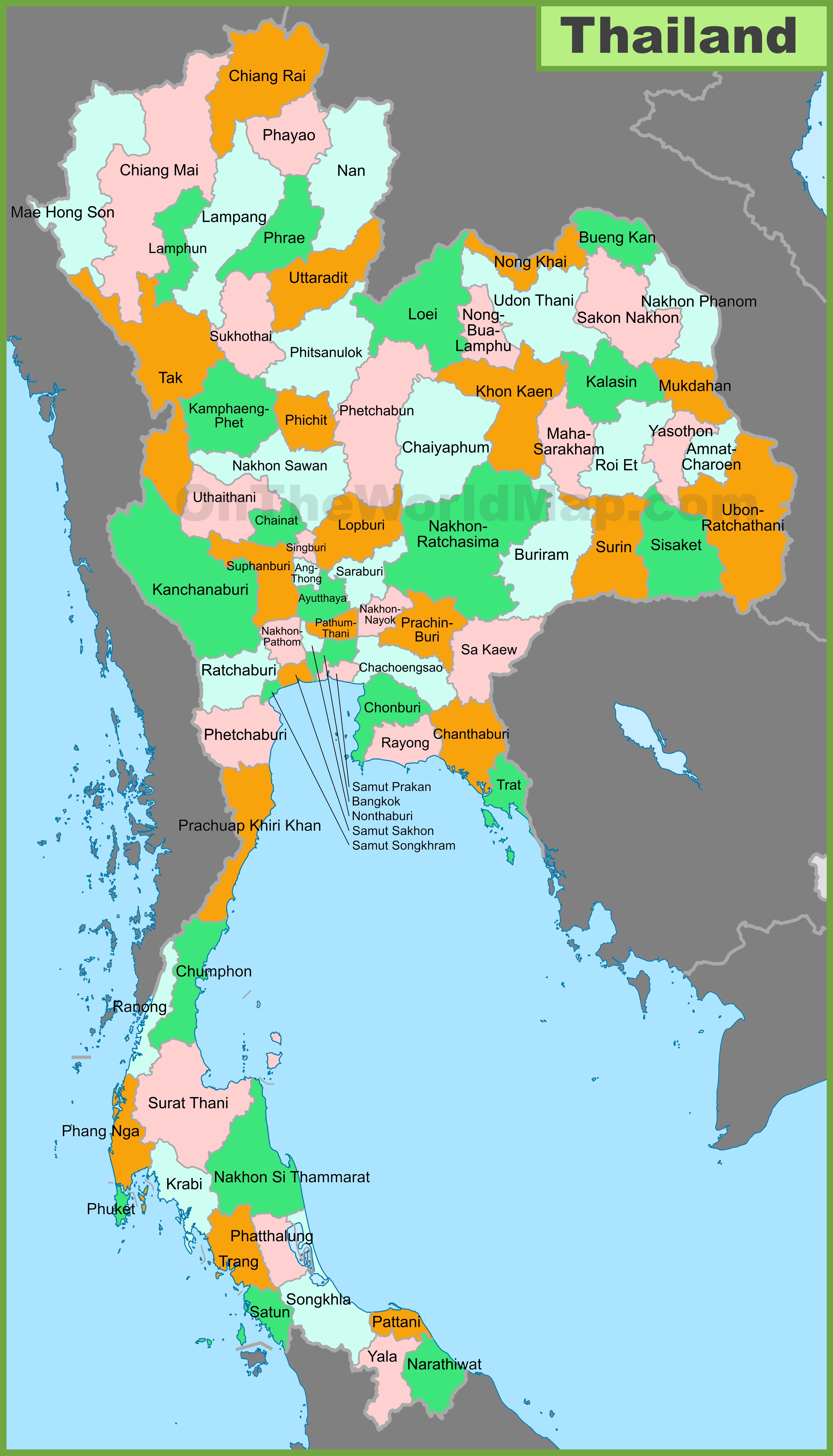
#3. This is a political map of
Thailand showing the main provinces and their areas. http://ontheworldmap.com/thailand/thailand-provinces-map.jpg
6 Urban Transportation
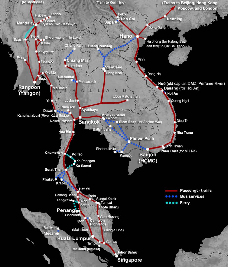
1. Here we can see transportation routes for traveling across Thailand, train being the main mode. The website is interactive, you can click on the map to see route times, train numbers, classes, costs etc. It even gives advice for best routes to get from Bangkok to other areas and how to purchase tickets. https://www.seat61.com/Map-southeast-asia-train-routes.htm
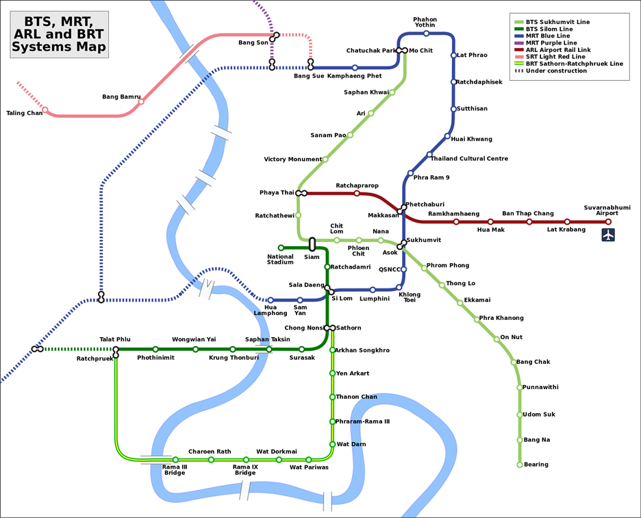
2. This is a map of the underground expressway in Bangkok. The website also had an interactive map that would be very helpful while there. http://www.metroeasy.com/bangkok-metro.html
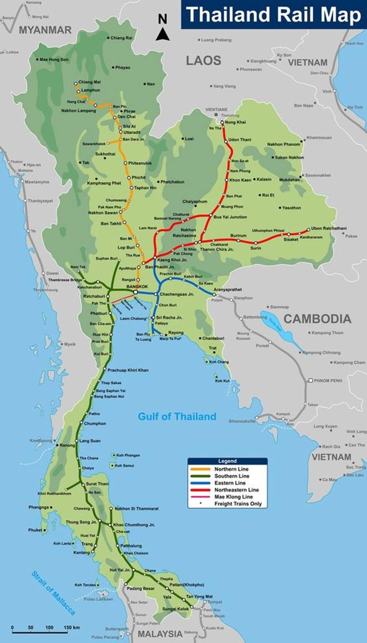
3. This is a map of the Rail lines in Thailand. It’s got cities names for all
the stops. Super helpful in planning transportation around the country. https://ourworldmaps.club/wp-content/uploads/2018/08/thailand-on-world-map-best-of-hua-hin-one-of-the-most-beautiful-places-on-earth-such-a-pleasure-of-thailand-on-world-map.jpg
7 Tourist Sites
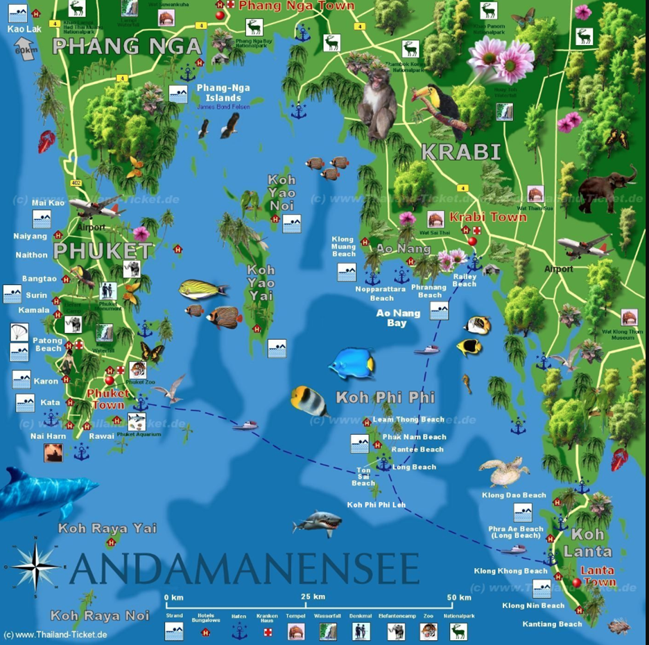
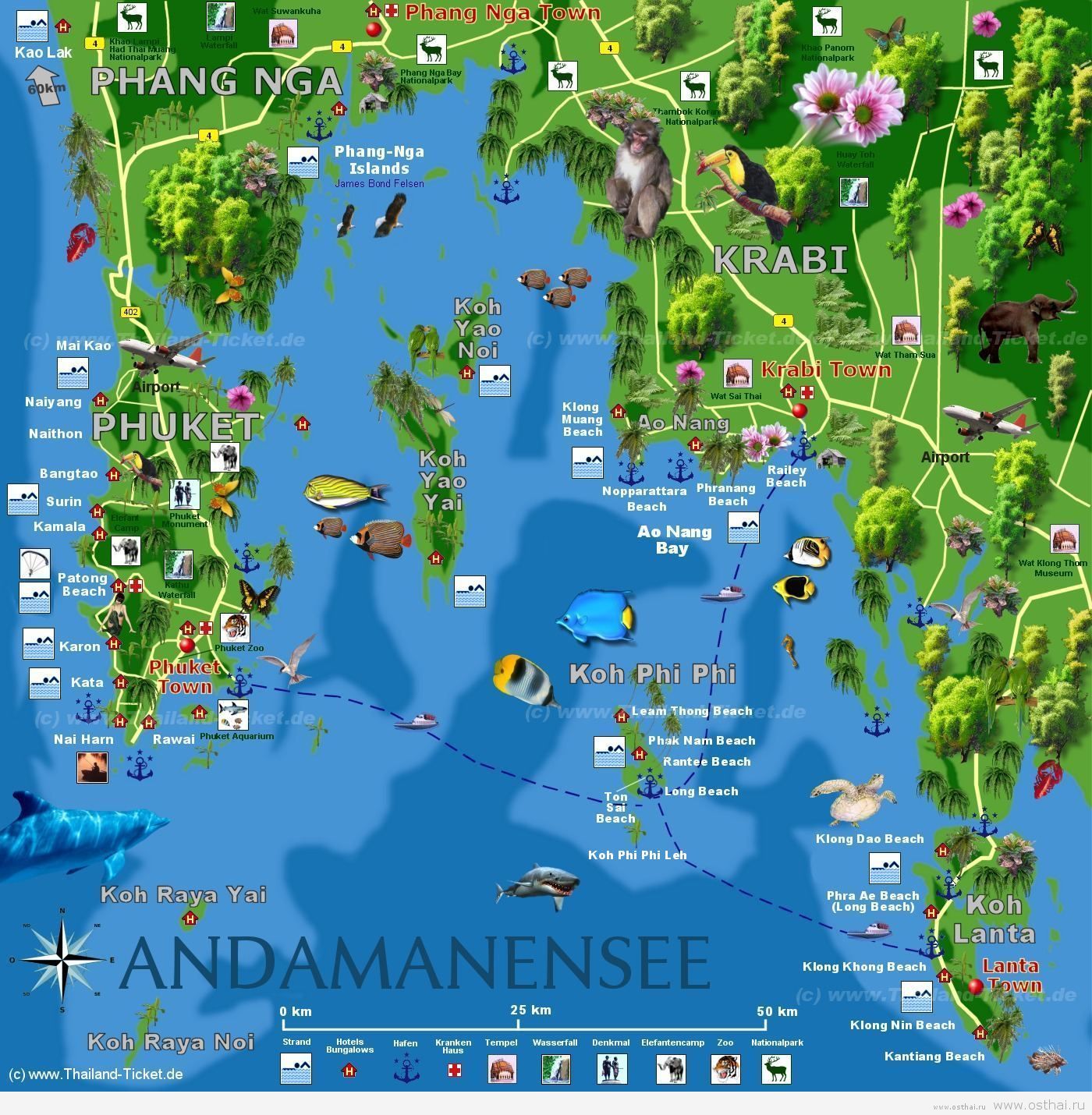
1. This is a tourist map of southeast Thailand. It shows beaches, airports, National parks, waterfalls, zoo’s, etc. This map would be very helpful in planning day to day itinerary. http://osthai.ru/wp-content/uploads/2011/12/krabi-koh-phi-phi-map.jpg

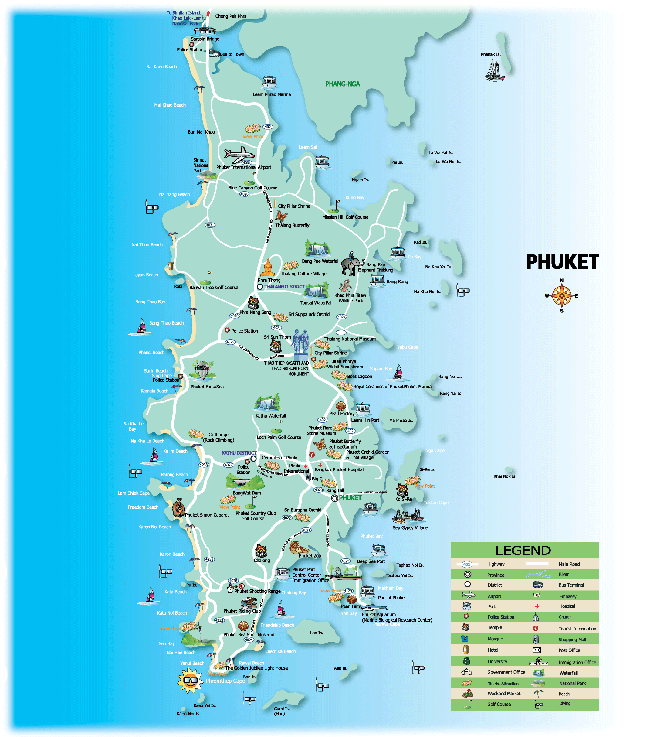
#2. This is a tourist map of Phuket. It shows all sorts of activates and locations, including the roads and road names on how to get there. IT has the ability to zoom in for better looks at roads on the website. http://www.mappery.com/maps/Phuket-Tourist-Map.png
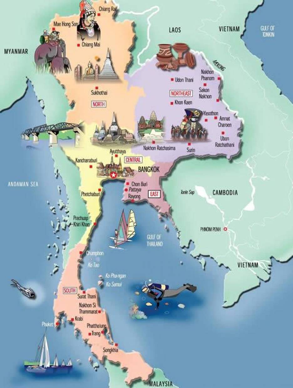
3. This is a map of the major attractions in Thailand. This will be helpful for planning itinerary. http://toursmaps.com/thailand-map-tourist-attractions.html
Submitted
by [Taylor Kocina] on [3/1/2019].